|
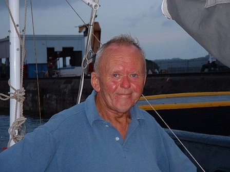
Masachapa, Nicaragua, March 18. N11.47, W086.31.
Hello, Friends:
Sometimes you have days that reassure you people
are decent. I didn’t intend to come to Nicaragua after leaving
Barillas in El Salvador last Friday, and was heading straight for Costa
Rica. It’s the mistake you often make, following the beaten track
because – well, because it’s the beaten track. I can thank the
Papagayos for getting me to Masachapa.
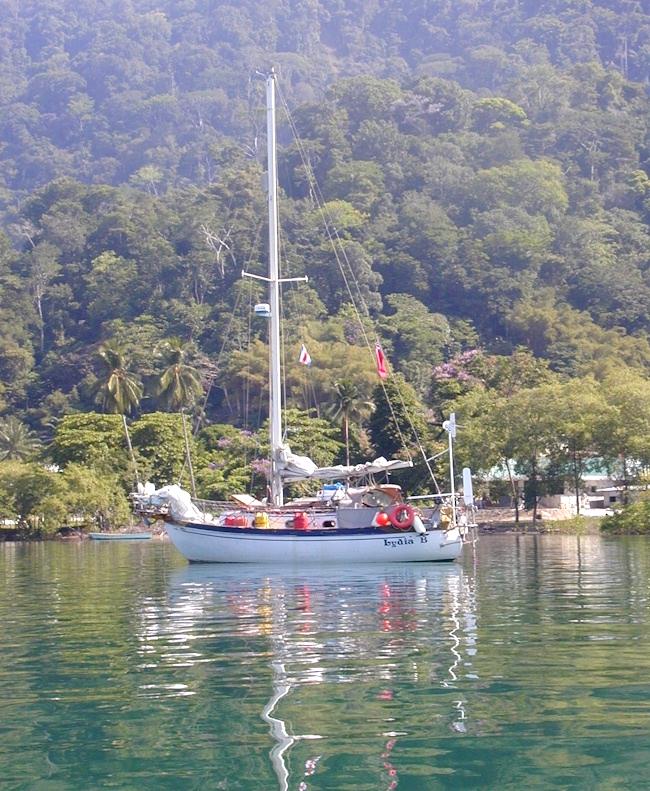
A small flotilla of five boats, Lydia B being much the smallest at 30
feet; Wings and Indara are 44 feet, Wild Blue about the same and Tai Tam
40 feet, sailed from Barillas together. This is the group that collected
at Huatulco in Mexico, if you remember from past episodes of this log,
waiting to cross the Gulf of Tehuantepec. We got across safely, of
course, and thought from then on we had the worst of the Central
American winds behind us. Not so.
Lydia and I cut a straight line overnight across
the Gulf of Fonseca , bordering El Salvador, Honduras and Nicaragua,
aiming for a brief stopover in a bay sailors have called No Name, for
the simplest of reasons. The other four boats hugged the shore, but with
much longer waterlines they’re normally faster than Lydia, so I
assumed they were all ahead of us by Saturday. Then the Papagayo wind
arrived, howling across gaps in the Nicaraguan mountains from
accelerated trade winds in the southeast Caribbean, and all of a sudden
a leisurely sail turns into something more hectic. Fully reefed and now
with only a staysail up front, we spent the next five or six hours
wetting our starboard deck as the Papagayo screamed off the shore at us
in regular bursts up to 40 knots. I concentrated non-stop, exposed in
the cockpit to mid-afternoon tropical sun, adjusting the Monitor
self-steering. Since Lydia has much in-built weather-helm, each gust
pulled us left of our track, and each time she had to be put back. The
ride was comfortable enough, and fast;. Lydia B really is a delightfully
tough sweetie in heavy weather. But by early evening
too much sun in the cockpit and too little sleep the night before had me
on the edge of hullucination. Bits of my memory of the previous 24 hours
were going missing. Masachapa is a township sprawled along the beach;
there’s no dock, but a local boat that had just passed me was anchored
there, so I called the day quits at 5.0 in the afternoon, dragged the
sails down, turned sharply left, nosed over shallow water watching the
depth-sounder all the way, dropped the anchor in the open roadstead
by the local boat and poured myself a whisky and ginger. It
seemed the sensible option.
No sooner had I done that than four fishermen in a
panga came alongside and suggested I might be in line for breakers
there. So I upped anchor again (and it’s a manual, not an electric
windlass. There’s 170 feet of 5/16 chain weighing a couple of
hundredweight, and an anchor another 35lbs) and followed them
half-a-mile along the beach to a safer spot. That’s where I now am.
The Papagayo is still howling, but since it’s an offshore wind the
seas are flat and Lydia’s sitting comfortably, held by a waterline
anchor pendant.
But where were the other four boats? I could hear
Indara’s VHF transmissions, but they failed to pick mine up. So where
were they? Here’s what Tom on Tai Tam told me in an e-mail sent on the
HF radio next day:
Hi
Ian,
We
really hope that this finds you in reasonable condition. I have tried to
hail you on 4A at our times but to no avail. We (Wings, Indara, Wild
Blue and Tai Tam) really got hammered yesterday afternoon with winds to
40 kts and very terrible seas wherever we went - closer to shore and
further out. We then
decided to put into the "No Name" anchorage at 11.30.444 -
86.10.247. Indara got here just at about 1800 and we pulled in at 1900
on Saturday. Wings, who did not put his sails up at all arrived at about
2200 and Wild Blue at midnight. What a ride! The wind was ok - we had a
3rd reef and the stay sail and the boat handled well with it - but the
short, choppy 3-4 secs. 6-8 ft seas really did a trick on the boat.
Water all over the dodger and bimini and then filling the cockpit. Then
my anchors worked a bit loose despite my serious setup to restrain them
and I had to go (naked) on to the bow with the boat plowing into the
seas and me getting fully submerged.
Anyway, I suspect that you may have set your storm sails and decided to
let the wind push you along further south. Let us know how you are
faring.
Fair
winds and be safe
Tom and Kathy
S/V Tai Tam
Here’s
the second message I sent back:
Tom
-- I re-read yr account of ydy and maybe didn't appreciate what a tough
time you all seem to v had. Did anybody take any damage? I hope t kids
are OK. Incidentally, I watched Wild Blue plunging quite markedly. She
looked as though she had too much sail forward -- wasn't built as a
ketch, by any chance? I'm puzzled, though. I thought all of you were
ahead of Lydia; but Wings & Wild Blue perhaps weren't -- I anchored
here at 1700 for my w & g. I maintained 5.5kts in the wind, and more
in t gusts, and it's only 27nm to No Name? I got your xmissions on 16
fine, but nobody seems to have picked mine up (tho I suspect I might v
bn on low power)?
Pse
remind me of t 4a(HF radio) times & I'll make a better effort to
tune in -- and thanks for being concerned. What's t plan now?
Bestest,
Ian,
Lydia B.
Well,
what we’re doing is sitting tight until these Papagayos slow down a
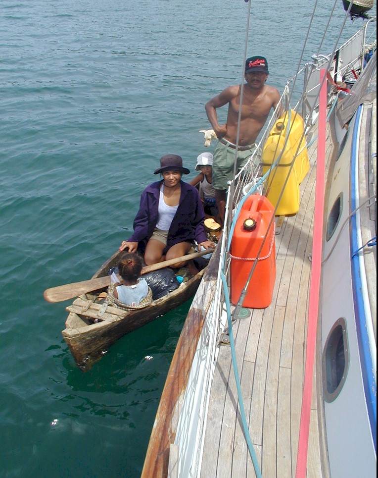
bit. Which is how I came to get more Nicaraguan hospitality today. Four
more panga fishermen came alongside, curious about this rare visitor
flying the British ensign alongside their own blue-and-white courtesy
flag. (Masachapa’s not on the beaten track. Everybody’s coming to
take a closer look). Before long they’ve gone back to pick me an
enormous bunch of mangoes from trees lining the shore, brought some ice
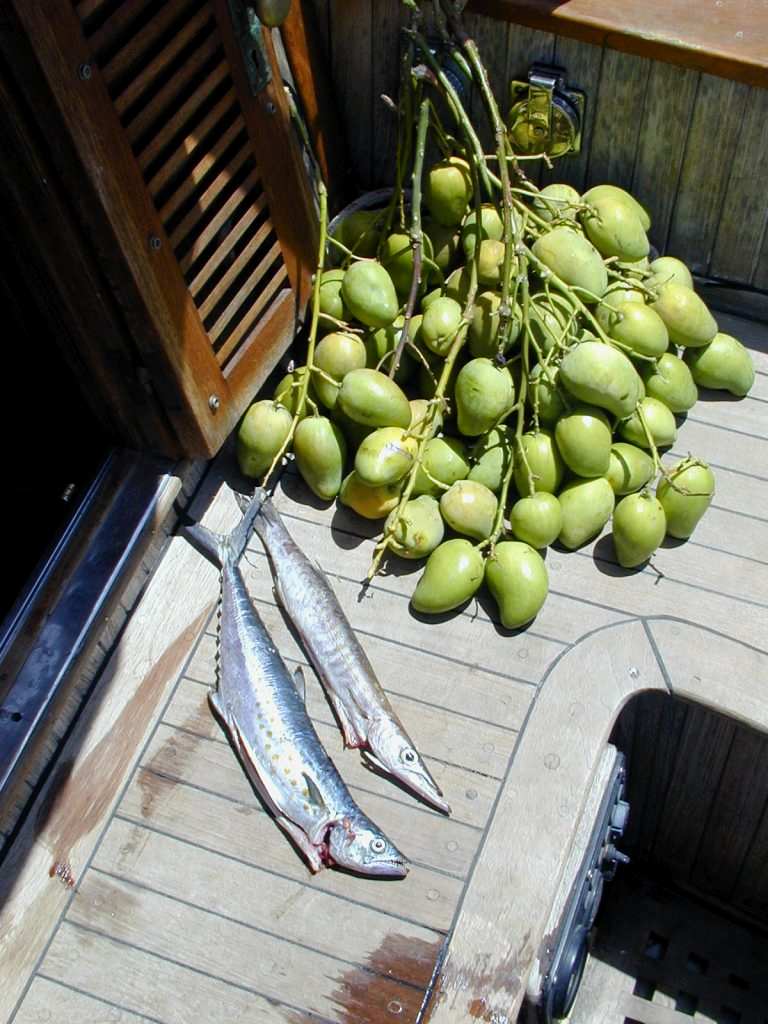
for Lydia’s rapidly warming cool-box and two freshly-caught fish – a
barracuda and a mackerel (though not quite the same as the Mackerel I’m
used to in England). I give them a few cans of beer and they reach into
their coolbox and give me a half-finished bottle of coca-cola. Against
all the security advice, I invite Danilo, the panga-owner and his mate
on board and show them round. They’re fascinated. Then they shake
hands, dive from Lydia’s side-deck, swim to their panga and wave
goodbye. These people are always smiling. They returned later in the
afternoon, this time bringing ripe melons, more fish and a full bottle
of coca-cola, plus a friend, Roberto. We sit in Lydia’s cockpit and
stumble with Roberto’s few words of English, my few words of Spanish
and much sign language through our histories. Danilo has two children,
one aged eight and one of a few months; Roberto has two and another on
the way. They look a little sadly at all Lydia’s electronics, and ask
how much my boat cost. I ask how much Danilo’s panga cost. Lydia would
buy a dozen Nicaraguan fishermen a fully-equipped panga each. Nicaragua
is so poor, says Danilo, GPS imports are not allowed. He eyes one of the
empty jerry-cans tied on deck. I need it, I say. Overnight I’ll think
I can spare it. I’ll also thin out my overfull wardrobe. It’s
unlikely Danilo and Roberto will go travelling in Europe when they
retire.
You
smile at the dragon and it smiles back.
I’m
spending the day writing this log, watching pelicans plunging from a
great height to catch fish in the sea and have just eaten the remains of
last night’s curry – a rarity, because in the 90-degree plus heat
here I’m not cooking an awful lot. Barracuda for supper tonight, of
course. I talk with other boats in Nicaragua, El Salvador and Costa Rica
at the 7.0pm schedule. Lydia’s sitting stern due south into the
Pacific, the ocean’s rolling under her keel towards the miles-long
sandy beach and the hot Papagayo’s still howling. Sometimes it’s
furious, though I’ve stopped looking at the wind-meter. The wind
generator’s working overtime -- but it’s keeping the battery-bank
full.
Love
& best wishes,
Ian.
Lydia B.
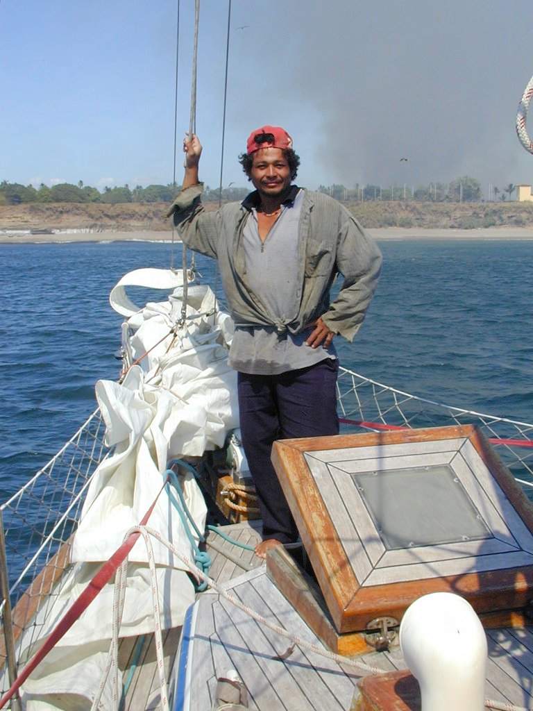
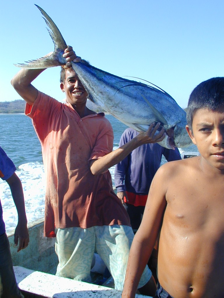
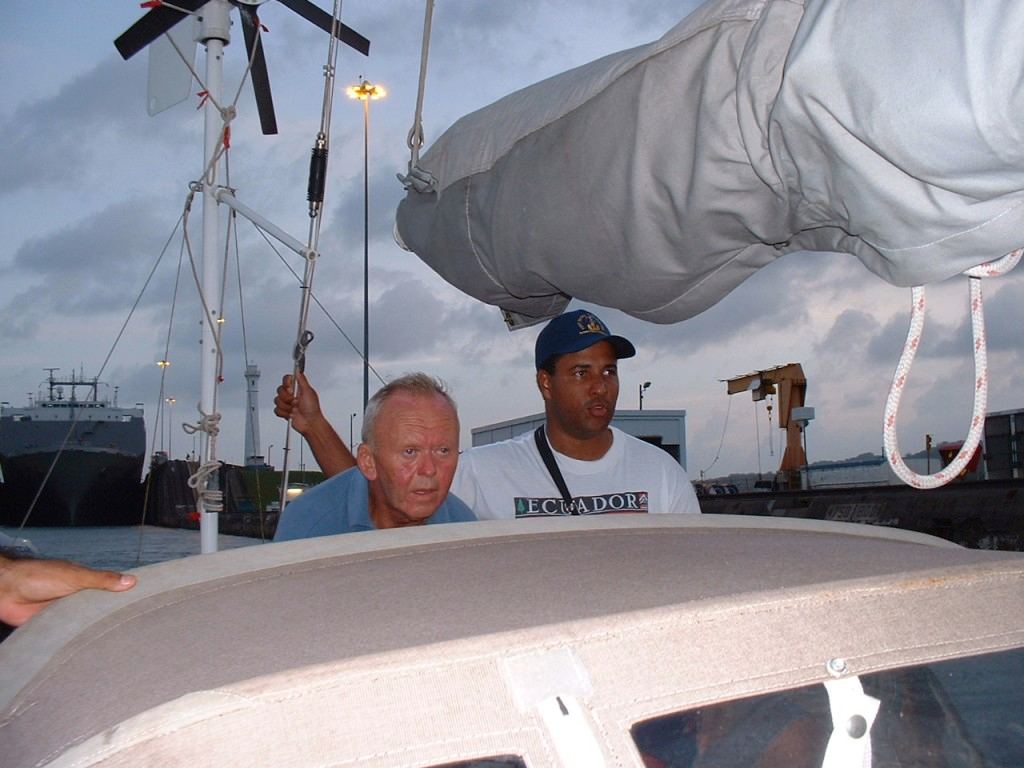
Leopoldo (L) and Danilo (R),
Nicaraguan fishermen aboard Lydia B at Masachapa.
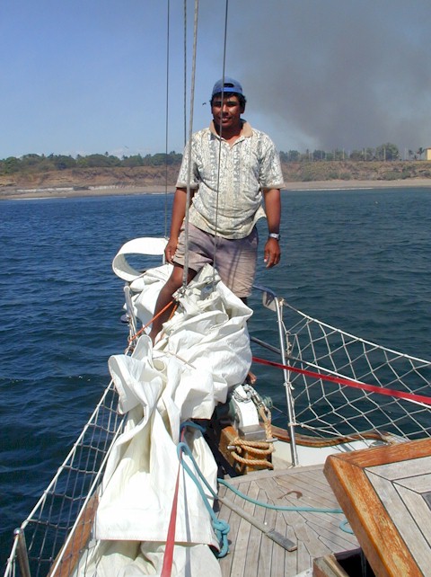
Roberto, Nicaraguan fisherman
and the gifts of mangoes, oranges and fish they brought.
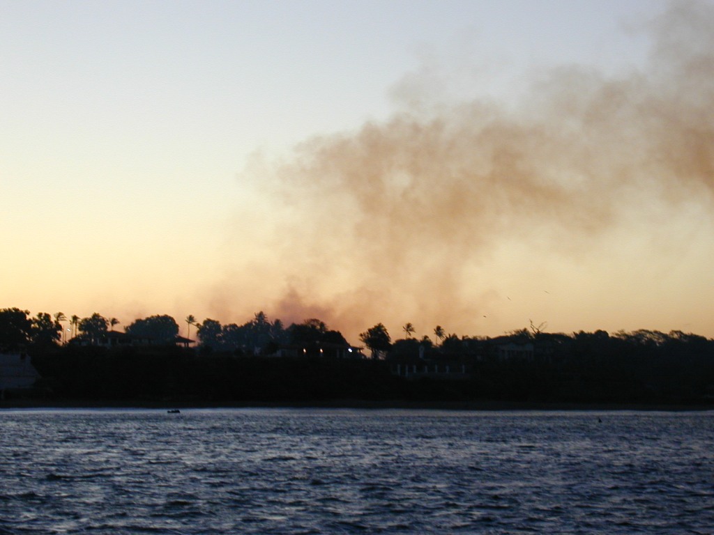
Sugar-field fire at Masachapa,
Nicaragua.
No
Name, Nicaragua, Thurs March 21. N11.30, W086.10.
Hello,
Friends:
I'm
trapped by wind at the bottom of Nicaragua. By 6.30 this morning I'd
taken the weatherfaxes from the US Coast Guard station at New Orleans,
Louisiana and was ready to go further south -- I'm only 650 miles from
Panama now, anxious to get there and turn north again in the
Atlantic.
But I won't be going anywhere today -- maybe not tomorrow either. Lydia
B's swinging at anchor in this out-of-the way bay which sailors call No
Name. I've no idea what the Nicaraguans call it; it's anonymous on the
chart. If I sneak in later (I haven't checked into Nicaragua yet) I'll
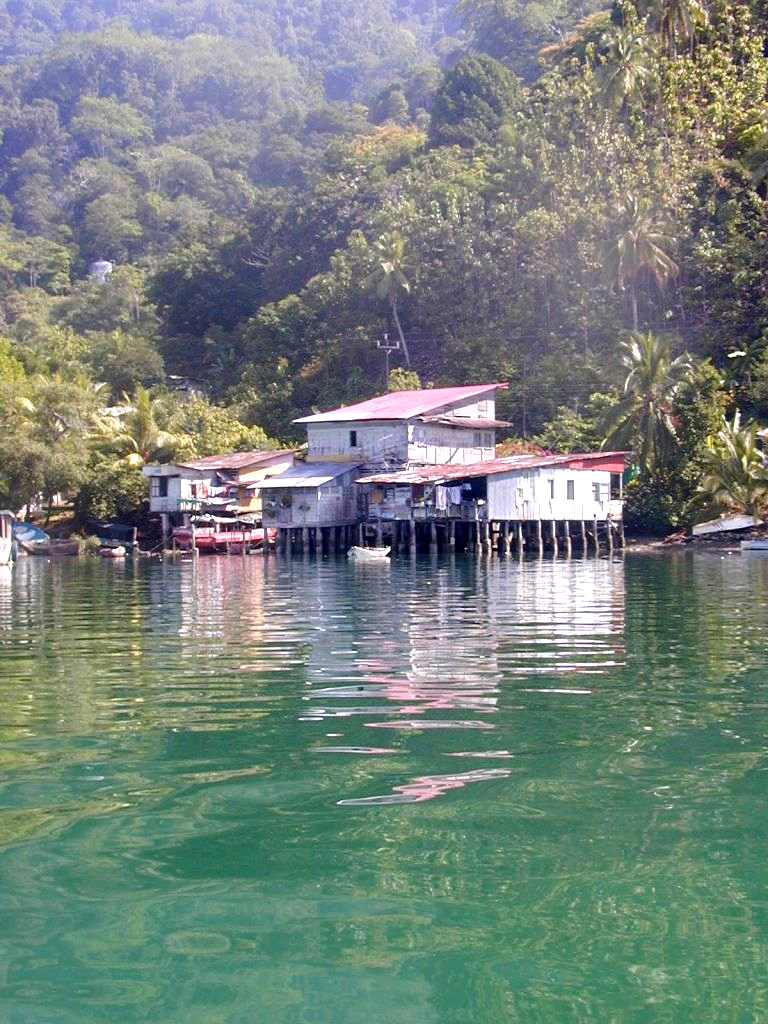
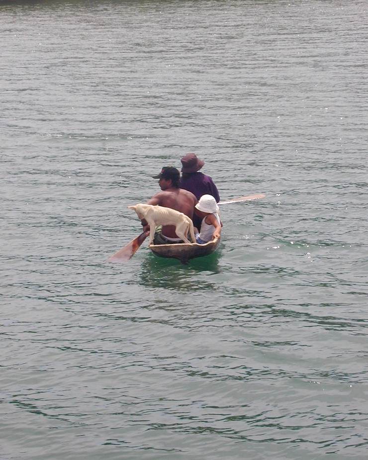
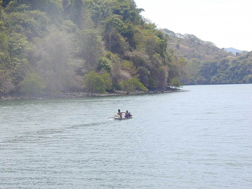
ask. It's inhabited by an apparently thriving Nicaraguan fishing
community whose pangas and open-sided, tin-roofed shacks line the beach.
There are street lights, traffic and a couple of smarter houses, too.
The place is beautiful. Folk here don't seem to notice the wind. The
pangas scoot in from and out to sea tending the nets, wind or no wind --
though to give me my due, they scoot at 35mph against Lydia B's 5. And
they have crew. Yesterday I tacked here for eight-and-a-half hours at
3.7 knots, Papagayo on the nose, bar a couple of degrees, keeping my
eyes peeled for fishing nets.
The
Papagayos are named after the Gulf in Costa Rica just a little way
south. Like the Tehuantepeckers we tasted a short while north, they
start in the Caribbean and come hurtling through gaps and over low land
(hereabouts over Lake Nicaragua), getting magnified by heat ashore. They
blow routinely at 30 knots (about 34mph); a gust was clocked at 63 knots
(over 70mph) by a cruising sailor a couple of weeks ago. His inflatable
dinghy was blown out of the water and burst. Best way I can describe it,
when a gust hits Lydia B, is this: her wind generator, mounted on an
eight-foot pole on the stern and normally more or less silent, suddenly
sounds like a propeller-driven aircraft throttling up at the end of the
runway for its take-off. The boat, all 7 tons, leans over, stretches the
sag out of the heavy anchor chain, pirouettes and starts to sail. Then
the gust passes and the chain sags again, pulling the boat back to where
it was. So far the anchor has stayed buried in the mud. The GPS -- who
said technology's no good? -- will buzz me if Lydia B moves more than 30
yards in any direction.
So
this morning I unhanked Lydia's head- and stay-sails, stowed them below
and hanked on the heavy storm jib (the mainsail was left double-reefed
from yesterday). I haven't got a lot of use for the regular headsails
right now. But the wind just got stronger. Now the forecast by one of
the amateur weather pundits -- who's very often right -- is for 40 knots
tomorrow (gusts come 40 percent higher). So I went nowhere, and nowhere
looks a possibility for tomorrow. Frustratingly, I've only got about 100
miles to go to finally say goodbye to the peckers and the papas. Then I
expect to be motoring in calm. That's the Pacific!
So
to while away the time (besides enjoying writing to you) I've e-mailed
NOAA (the U.S. National Oceanographic and Atmospheric Administration) --
that's the outfit that does all the weather predictions and sends them
out by fax to people like me on boats -- to ask them why their forecasts
for the Papagayo area seem consistently to bear no relation to
actuality. It's lore among sailors. Today, as with most daily
under-estimates, they forecast 15 knots. That would get anybody's
grandma and granddad out on the water for a pleasant day's sail. (I
thanked them very much, though, for the vital service they provide).
Back
comes a very prompt e-mail from Martin C Nelson, lead forecaster at
NOAA's Tropical Prediction Centre in Miami:
"ZQLW6@sailmail.com
wrote:
>
consistent discrepancies between your wind strength forecasts for
the inshore Pacific side and actual conditions.
'Yes.
A very difficult area for us for us to forecast, similar to our
problems in the Sea of Cortez. We
rarely receive ship reports and there are many errors in the reports we
do receive. The local
terrain has many effects on the near shore waters, turning strong winds
on/off at different times of the 24 hour day.
Our models don't
work well close to land under local influences.
Also, some of our best polar-orbiting satellite observing tools
are contaminated close to shore.
In practice we look to what is happening on the Caribbean side to try to
guess at upcoming conditions here.
Our practice as well...except that there is a flotation in the winds on
the E Pac side of Central America, and often the increase in winds has
been going on for several hours before we see observations..'
>
My experience is that you are more accurate for the Gulf of Tehuantepec,
which I've just crossed with your help.
'Easier
because we have developed techniques based on consistent observations
that occur hundreds of miles to the north both on land and on stationary
buoys. Also Tehuantepec is
much larger.
Sorry for the bad forecasts and we will strive to get better in that
area.
Martin C Nelson."
Isn't
that nice!
I
think I'll get the clippers out and try and give myself a haircut
tonight. If I had spare water I'd do some washing -- the boat, I mean.
It's caked from stem to stern in sun-baked salt washed aboard in the
last few thousand miles. On top of the salt is a thick layer of dust,
made airborne over great areas by constant sugar-field fires. Sails,
sheets and halyards are now Central American terra cotta colour. But I'd
better wait and see when I'm getting out of here. I might need all
that's left of the 90 gallons I put aboard in El Salvador.
Love
& best wishes,
Ian.
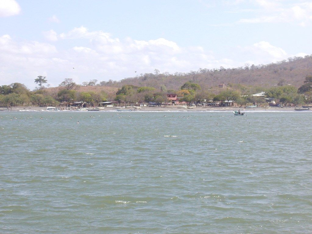
The beach community at No Name (Aspierta),
Nicaragua.
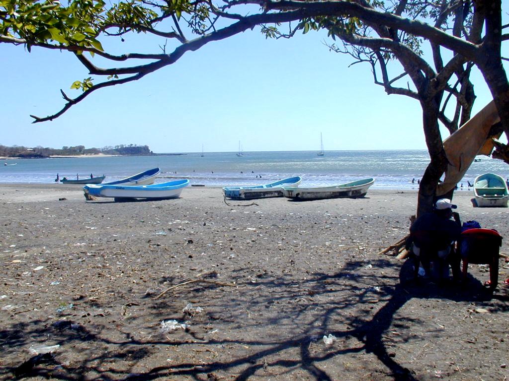
No Name beach, Nicaragua --
Lydia B anchored far left.
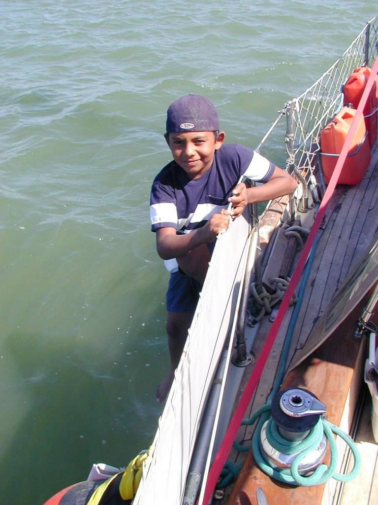
Nicaraguan panga-boy on Lydia B
at No Name.
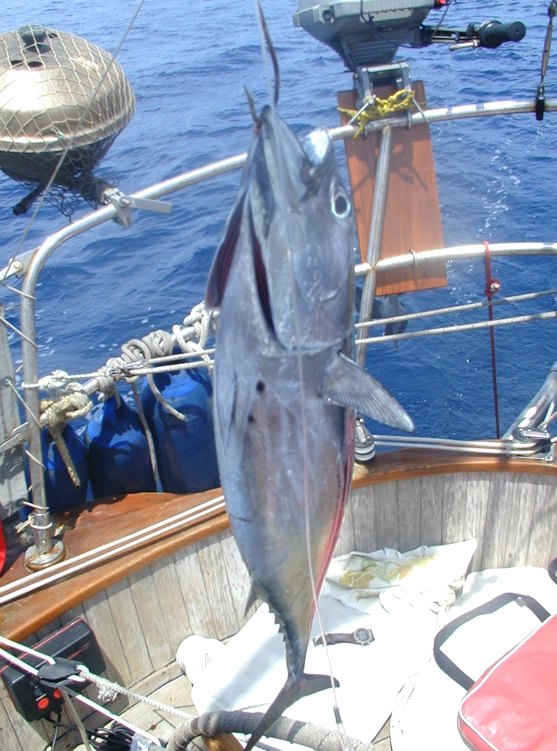
Skip-jack tuna catch at No Name,
Nicaragua.

Boat crews and Nicaraguans, No
Name.
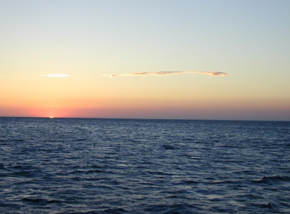
Pacific sunset at No Name,
Nicaragua.
Playa del Coco, Costa Rica, March ?/02
Hello, Friends:
At last! Lydia B escaped the Nicaraguan wind-trap.
We got out of No Name (which is really called Aspierto by the
Nicaraguans who live there – don’t ask me why sailors don’t
recognize it) and sailed overnight
for Costa Rica as soon as the winds eased. These days we’re
quite happy with 25 knots of wind on the nose, and that, for part of the
45-mile escape passage to Bahia Santa Elena in Costa Rica, was what we
got. Two more American boats joined the rush – Sailmates and
Ku’uipo, both headed for Panama and the east coast of the U.S.
A brief stop in Elena, reached early in the morning
when we discovered the local chart was wildly inaccurate and thought
better of navigating through the rocks in the darkness, and we were off
again into quite crazy seas and 35 knots of wind round Cabo Santa Elena
and into the Gulf of Papagayo. It’s an education in timidity and
trust. These boats seem as if they’ll take any punishment the weather
throws at them. All three ran before, then beat into a relentless
Papagayo, flying the tiniest bit of reefed mainsail we could manage, all
of us flat in our starboard beams – then all of a sudden it gave up,
stopped dead and went flat calm. We motored the rest of the way into
Bahia del Coco, the northernmost Costa Rican port of entry, dropped the
hook and called it whisky and ginger time.

Ku'ipo (Cheoy Lee, nearest) and
Sailmates (Sparkman and Stephens) anchored at Bahia Santa Elena,
northern Costa Rica.
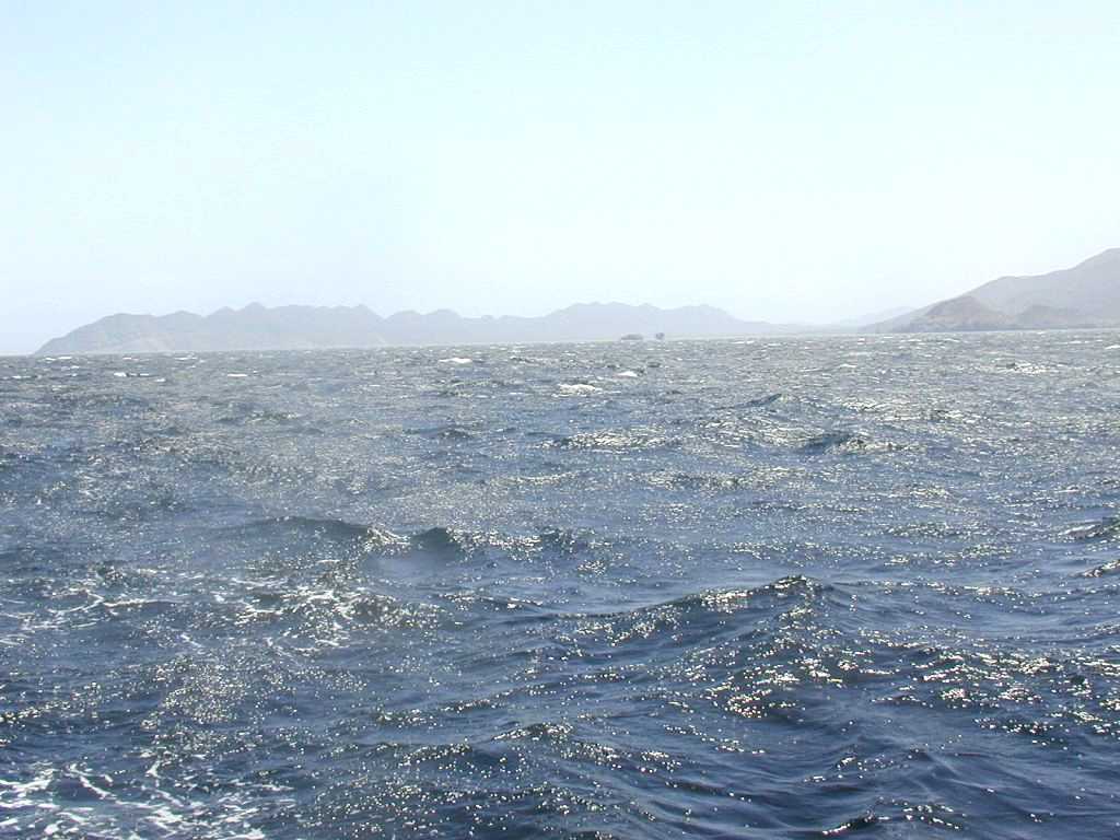
Wild seas and Papagayo winds
outside Bahia Santa Elena, Costa Rica, that belied the calm inside.
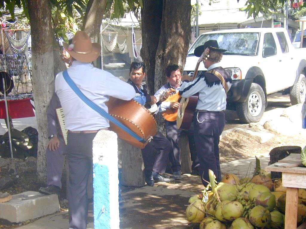
Street musicians at Playa del
Coco, Costa Rica.
Street dress at Playa del Coco,
Costa Rica.
Quepos, Costa Rica,
Monday, April 1. N09.25, W084.10.
Hello Friends:
In case anyone thought I’d
abruptly jumped overboard at the end of the last (unsigned –
sorry!) log piece, I’m still aboard Lydia B. We’re back on the fast
track to Panama. I pulled
into this little Costa Rican fishing town at dawn after overnighting
across the Gulf of Nicoya. This time the Papagayos are behind me for
good. They bade us a lusty farewell as we rounded Cape Velas in company
with Sailmates and Ku’uipo, the two American boats who’ve been
Lydias’s companions for the last week or so. Then, quite suddenly,
they gave up. For the first time in three weeks the offshore howling
stopped and a balmy new wind
coming off the Pacific picked us up and led us gently to Bahia Potrero,
then Bahia Carrillo and now to Quepos. It’s so long since I’ve been
able to make toast and marmalade, and fresh-ground coffee, while Lydia
sails herself in steady winds. Yesterday I had time as we bowled along
to make some salad and eat
more of the tuna I caught the day before with a towed line. It
was a skipjack; not the gourmet’s favourite and as dark-fleshed as
beef, but it tasted pretty
good to me.
In the Gulf of Nicoya – gateway to Puntarenas,
Costa Rica’s main Pacific shipping port – we stayed awake on the
radar, dodging incoming and outgoing freighters. Twice in the darkness
we appeared to be on a collision heading and twice Lydia’s course was
changed at the last minute to let a tanker and a freighter pass across
her bow. They probably saw us. We hope so.
I’ll unpack the inflatable today. I need to scrub
Lydia’s waterline. It’s bright green with slime and weed accumulated
in the last month or so as we head into warmer and warmer waters.
Lydia’s taken so much punishment from the Papagayos that the least I
can do for her is freshen her up. I’ll polish the brass, too. The
trawler lamp that hangs over the galley, and the brass post that’s
such a feature of these boats are green and spattered with salt spray.
Then – if Costa Rican officialdom is back at work after the Easter
festivities – I’ll check out of the country to leave tomorrow and go
further south. There are only eight degrees between us and the Equator.
Love & Best wishes,
Ian,
Lydia B.
Balboa, Panama,
April 14, 2002.
Hello Friends:
So this is why we do it. It’s romance. It’s why
we endure moonless nights groping through the darkness in our little
boats thousands of miles from home; getting thrown around by big, driven
seas and breaking waves we can’t see until they hit us; getting tired,
wet, hungry and sometimes a little afraid; always hoping to get there
soon and safe. Sometimes, of course, sailing exhilarated in tropical
sunshine on blue water under a blue sky, Lydia B leaning to a steady 15
knot breeze on her favourite quarter, a white bow wave curling out as
she puts mile after mile under her keel, led by playing dolphins,
sailing herself while I make another cup of tea. The reason’s here at
the Panama Canal.
My little boat and I sailed here last Thursday,
tied to a mooring at Balboa Yacht Club and are now 4,683 miles away from
the friends we left in British Columbia, Canada. That’s the United
States, Mexico, Guatemala, El Salvador, Nicaragua and Costa Rica ago.
Some of them, like family and friends in England, have sometimes asked
why I’m doing it. The answer – as good as I can think of, anyway –
is in watching the freighters from every corner of the globe that arrive
non-stop, 24 hours a day, every day of the year to cross this amazing 50
miles of engineering that link the Pacific to the Atlantic. It links
people everywhere in the world by trade. It’s what happens with so
much of what we buy in supermarkets and drive on roads everywhere,
before it reaches the neat, clean, clear-wrap stage.
I’m moored at the Pacific end of the canal – I’ll
take Lydia B through it in another week – right by the Bridge of the
Americas, linking central to south America. The freighters pass,
separated by feet, in both directions up a narrow channel a couple of
hundred yards from my mooring, rocking Lydia with each passing wake.
‘Bow Heron’, a chemical tanker from Norway; ‘Asian Olive’,
a banana carrier from Singapore; ‘Sea Tiger’ from Hamburg, stacked
with containers so high on deck you wonder how the vessel doesn’t fall
over; ‘Nerano’ from Malaysia with oil; car-carriers, general
freighters, smart new ships, rusty old ones; fully laden ones, empty
ones; some clanking, some purring. A few imposing white cruise liners
too. And, of course, an accompanying stream of Panama Canal Authority
tugs and pilot boats beetling never-endingly back and forth to meet new
customers.
Trade, pleasure – its all here at the Panama
Canal. I wonder if John Masefield passed by here (you know – ‘I must
go down to the sea……’). Though
it’s been administered by the United States for much of this century
and Balboa has nothing if not a stately American colonial feel with its
grand, cream-coloured buildings and wide, palm-lined avenues (so like
the colonial elegance of Raffles Singapore and Semiramis Cairo), it’s
now entirely in Panamanian control. The taxi-driver pointed out General
Noriega’s ex-headquarters (remember him?) when we passed on the way to
Flamenco to find old tyres to use as Lydia B’s extra fenders in the
canal.
The canal is part of Panama’s staple income.
Transit fees for Lydia B – all 30 feet of her – will amount to about
US$700. That includes having her officially measured to see if she fits
the canal – after all, she’s just another ship as far as the canal
authority’s concerned. She’ll be just another name on the day’s
transit list.
The big ships pay something like $45,000 dollars
each time they go through. (I haven’t counted them, but there seems to
be one every 20 minutes or so, round the clock. Officially there are
13,000 transits a year. That works out at about a billion dollars
annually). The alternative for us all, of course, is quite a long way
round Cape Horn, not without its own discomforts. So maybe it’s a
bargain at the price. We’ll motor through – sailing isn’t allowed
– flying the national (British merchant navy red in Lydia’s case)
ensign in its usual place on the backstay, and the Panamanian courtesy
flag from the starboard yard-arm, exactly the same as the big ships
ahead of us. I wonder if they’ll see, painted on Lydia’s starboard
quarter, her port of registry – ‘Maryport, UK’ –and wonder where
Maryport is. A century ago, of course, before the advent of the Panama
canal, they surely would have known, because these Cumbrian places were
once major Atlantic trading ports.
Isn’t this just the stuff of romance!
Then I have to have an official canal authority
adviser aboard, plus four line handlers to keep us in position when the
lock chambers start boiling with incoming water to lift us over the
Central American isthmus; and they’ve all got to be fed. We’ve got
some homework to do before we start out. Luckily I’ll be re-joined by
Rachel, who sailed with me and Lydia between the Queen Charlotte Isles,
on the Alaska border in the far north of British Columbia and San Diego,
southern California, on the border with Mexico..
I’ve already forgotten about the Tehuantepeckers
and the Papagayos, the merciless offshore winds that gave us such a
buffeting off El Salvador, Guatemala, Nicaragua and Costa Rica. They’re
part of the memory, and a distinct building-block in our sailing
experience, for I feel now there’s little that Lydia B won’t take us
safely through, if we do as she tells us to do. She understands the
seas. They’re a bonding process, and I’m a little in awe of this
boat. She’s been cleaned underwater, we have a few small sail repairs
to do, the brass is being polished, her water and diesel tanks filled
again, fresh stores put aboard and an electrical glitch with navigation
lights to investigate. I suspect there’s a salt-water short-circuit in
the forward chain locker. So far she’s enjoyed every nautical mile of
the way. I think she’s looking forward to the Atlantic, going north
and long summer days after the twelve hours each of light and dark this
near the equator. We’re at 07 degrees North now, but we’re headed
steadily north from here since Punta Mala at the bottom west side of the
Gulf of Panama last Wednesday. It’s
a good feeling to be pointed towards my northern roots.
Then we’ll set off for Miraflores, Pedro Miguel
and Gatun locks, probably holding our breath, hopefully in company with
friends on other boats we’ve got to know on the long way to Panama.
Love & best wishes,
Ian,
Lydia B.
L - Hot day aboard Lydia B in
the Pacific off Nicaragua. R - Skipjack tuna for supper.
Costa Rican homes at the old
banana port of Golfito.
Lydia B at Golfito, Costa Rica.
Family comes visiting for trade,
Bahia Honda, Panama.
Family goes home, Bahia Honda,
Panama.
Lydia B enters the channel to
Balboa, Panama canal.
The big and the small, Balboa,
Panama Canal.
L - Mega, Balboa.
R - Lydia B attired for the canal.

Tony, taxi-driver and chief
Panamanian line handler aboard Lydia B for the canal transit.
L - anxious moment with Lydia B
and canal pilot. R - anxious moment past.
Out into the night at Cristobal,
Atlantic Panama.
Balboa, Panama, April 20/02.
Hello, Friends:
Lydia B and I are still at the Pacific end of the
Panama canal, lined up in the queue of boats waiting to do the transit.
There’s a backlog, and we’ve been given a tentative date of April
29. We’ve been officially measured and have all our extra fenders and
handling lines aboard for the three sets of canal locks. Since the
weather window in the Caribbean is limited – the hurricane season
officially starts on June 1 – it’s a bit frustrating to be sitting
here and not sailing north.
Still, that’s life. We’ve been told to keep
checking with the Panama Canal Authority’s traffic people in case the
date gets shifted forward. Sailors are optimists.
So I’m using the time to do some housekeeping .
I’ve emptied and cleaned Lydia’s 7.0 cu ft coolbox (we don’t have
a ‘fridge, so we’re dependent on supplies of ice. They’re
obtainable pretty well everywhere here – combatting heat is a
universal activity in these latitudes). Poorly ventilated shipboard
places like fridges tend to be bacteria traps. I’ve also cleaned the
bilge, receptacle for everything that flows in and drains to the
boat’s bottom – melted ice from the coolbox, sea-water drip-dripping
through the stuffing-box, the bit below water level that keeps the
propellor shaft sealed and lubricated, water splashed around in the
galley and the head --
anything that spills. And, of course, rain coming in, which is what
happened two nights ago during long and heavy rain. Since I was engaged
in long and heavy sleep – with all the hatches and portlights open ,
of course – things got wet, including my bunk. The rain’s welcome,
though. It brings cooler air with it. It will also help to wash away the
salt of the sea and the terra cotta dust of Central American sugar fires
that have coated Lydia for weeks now.
It’s been quite a domestic few days. The new
mainsail we blew the mast slides off way back at Turtle Bay in Mexico
now has new slides. I spent part of yesterday with sailmaker’s
needles, palm and waxed thread cross-legged in the cockpit sewing new
ones back on. My head is rejoicing. For the last six weeks I’ve had to
use the old mainsail, kept aboard as a spare. It has a considerably
longer leech – the back edge of the sail – than the new one, which
means that the boom is much lower. So low that it’s below my head
height when I’m standing. Repeated bruises
-- booms always hit the same old bruise -- show how painful that
has been. I never got used
to it. But I had the new main made with a shorter leech specifically to
raise the boom clear of my head. It’ll go back up today.
Meanwhile I’ve been looking through the hundreds
of digital photographs I’ve taken since I left San Diego, California,
on January 21. Here’s a few of my own favourites. I’m not sure what
they represent, if anything in particular. Except it’s hard to ignore
the extraordinary colour and happy, unkempt, make-do bustle of life in
Central America.
Love & best wishes,
Ian,
Lydia B, Balboa.
Introduction 0
- Inside Passage and northern British Columbia
1
- British Columbia to El Salvador
3
- San Blas to Florida
4
- Intra-Coastal Waterway to Washington DC 5 - Brentwood Bay BC and Chesapeake
6
- Virginia, Atlantic to Azores
7 - Azores, Ireland to England
8
- Chevy through the US - 1 9
- Chevy through the US - 2
|